This function provides an interface mirroring that of the GDAL
command-line app gdalmdimtranslate. For a description of the
utility and the arguments that it takes, see the documentation at
https://gdal.org/programs/gdalmdimtranslate.html.
Usage
gdalmdimtranslate(
  src_filename,
  dst_filename,
  ...,
  co,
  IF,
  of,
  array,
  group,
  subset,
  scaleaxes,
  oo,
  config_options = character(0),
  dryrun = FALSE
)
Arguments
- src_filename
Character. Path to a GDAL-supported readable datasource.
- dst_filename
Character. Path to a GDAL-supported output file.
- ...
Here, a placeholder argument that forces users to supply exact names of all subsequent formal arguments.
- co, IF, of, array, group, subset, scaleaxes, oo
See the GDAL project's gdalmdimtranslate documentation for details.
- config_options
A named character vector with GDAL config options, of the form
c(option1=value1, option2=value2). (See here for a complete list of supported config options.)- dryrun
Logical (default
FALSE). IfTRUE, instead of executing the requested call to GDAL, the function will print the command-line call that would produce the equivalent output.
Examples
# \donttest{
## A simple dataset bundled with the sf package
FF <- system.file("nc/cropped.nc", package = "sf")
td <- tempdir()
out_tiff <- file.path(td, "out.tiff")
gdalinfo(FF)
#> Driver: netCDF/Network Common Data Format
#> Files: /home/runner/work/_temp/Library/sf/nc/cropped.nc
#> Size is 512, 512
#> Metadata:
#>   NC_GLOBAL#Contact=Dick Reynolds, email: Richard.W.Reynolds@noaa.gov & Chunying Liu, email: Chunying.liu@noaa.gov
#>   NC_GLOBAL#Conventions=CF-1.0
#>   NC_GLOBAL#creation_date=2011-05-04
#>   NC_GLOBAL#History=Tue Feb 13 20:40:49 2018: ncks -d lat,30,40 -d lon,25,50 avhrr-only-v2.19810901.nc -O cropped_example.nc
#> Version 2.0
#>   NC_GLOBAL#NCO=4.6.8
#>   NC_GLOBAL#Source=NOAA/National Climatic Data Center
#>   NC_GLOBAL#title=Daily-OI-V2, final, Data (Ship, Buoy, AVHRR, GSFC-ice)
#> Subdatasets:
#>   SUBDATASET_1_NAME=NETCDF:"/home/runner/work/_temp/Library/sf/nc/cropped.nc":anom
#>   SUBDATASET_1_DESC=[1x1x11x26] anom (16-bit integer)
#>   SUBDATASET_2_NAME=NETCDF:"/home/runner/work/_temp/Library/sf/nc/cropped.nc":err
#>   SUBDATASET_2_DESC=[1x1x11x26] err (16-bit integer)
#>   SUBDATASET_3_NAME=NETCDF:"/home/runner/work/_temp/Library/sf/nc/cropped.nc":ice
#>   SUBDATASET_3_DESC=[1x1x11x26] ice (16-bit integer)
#>   SUBDATASET_4_NAME=NETCDF:"/home/runner/work/_temp/Library/sf/nc/cropped.nc":sst
#>   SUBDATASET_4_DESC=[1x1x11x26] sst (16-bit integer)
#> Corner Coordinates:
#> Upper Left  (    0.0,    0.0)
#> Lower Left  (    0.0,  512.0)
#> Upper Right (  512.0,    0.0)
#> Lower Right (  512.0,  512.0)
#> Center      (  256.0,  256.0)
gdalmdimtranslate(FF, out_tiff, array = "sst")
gdalinfo(out_tiff)
#> Driver: GTiff/GeoTIFF
#> Files: /tmp/RtmpdRuzGn/out.tiff
#> Size is 26, 11
#> Origin = (6.250000000000000,-82.500000000000000)
#> Pixel Size = (0.250000000000000,0.250000000000000)
#> Metadata:
#>   long_name=Daily sea surface temperature
#>   valid_max=4500
#>   valid_min=-300
#> Image Structure Metadata:
#>   INTERLEAVE=BAND
#> Corner Coordinates:
#> Upper Left  (   6.2500000, -82.5000000)
#> Lower Left  (   6.2500000, -79.7500000)
#> Upper Right (  12.7500000, -82.5000000)
#> Lower Right (  12.7500000, -79.7500000)
#> Center      (   9.5000000, -81.1250000)
#> Band 1 Block=26x11 Type=Int16, ColorInterp=Gray
#>   NoData Value=-999
#>   Unit Type: degrees C
#>   Offset: 0,   Scale:0.00999999977648258
#>   Metadata:
#>     DIM_time_INDEX=0
#>     DIM_time_UNIT=days since 1978-01-01 00:00:00
#>     DIM_time_VALUE=1339
#>     DIM_zlev_INDEX=0
#>     DIM_zlev_UNIT=meters
#>     DIM_zlev_VALUE=0

## A more interesting dataset bundled with the stars package
if(require(terra)) {
    FF <- system.file("nc/reduced.nc", package = "stars")
    gdalinfo(FF)
    td <- tempdir()
    out_1_tiff <- file.path(td, "out_1.tiff")
    gdalmdimtranslate(FF, out_1_tiff, array = "sst")
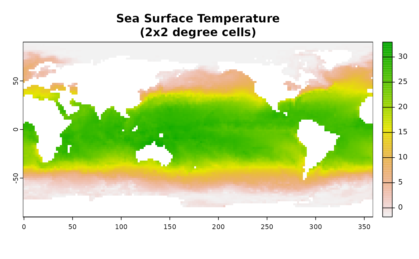
    plot(rast(out_1_tiff),
         main = "Sea Surface Temperature\n(2x2 degree cells)")
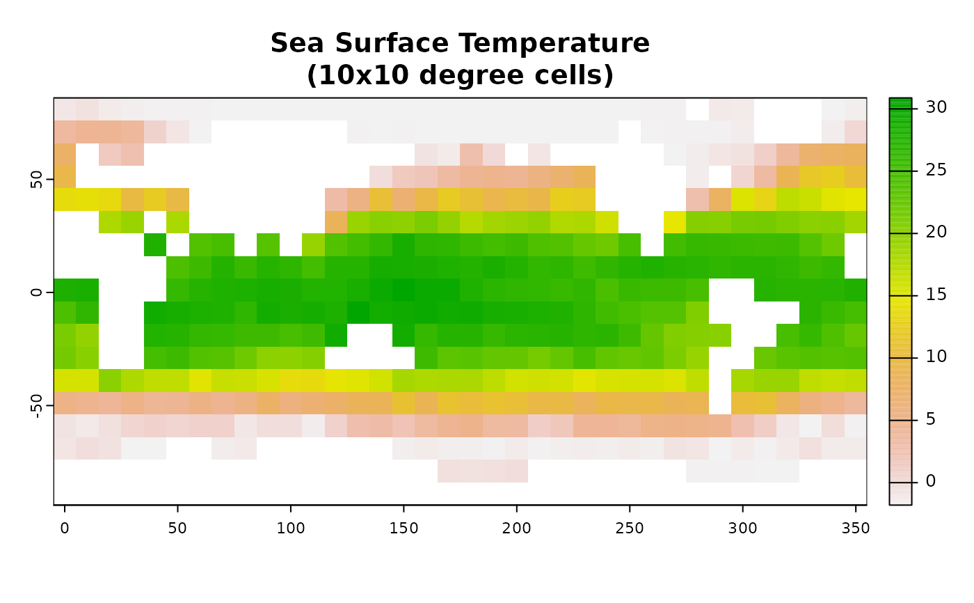
    ## Translate to a tiff, coarsen by a factor of 5
    out_2_tiff <- file.path(td, "out_2.tiff")
    gdalmdimtranslate(FF, out_2_tiff, array = "sst",
                      scaleaxes = "lon(5),lat(5)")
    plot(rast(out_2_tiff),
         main = "Sea Surface Temperature\n(10x10 degree cells)")
}
#> Driver: netCDF/Network Common Data Format
#> Files: /home/runner/work/_temp/Library/stars/nc/reduced.nc
#> Size is 512, 512
#> Metadata:
#>   NC_GLOBAL#CDI=Climate Data Interface version ?? (http://mpimet.mpg.de/cdi)
#>   NC_GLOBAL#CDO=Climate Data Operators version 1.9.0 (http://mpimet.mpg.de/cdo)
#>   NC_GLOBAL#Contact=Dick Reynolds, email: Richard.W.Reynolds@noaa.gov & Chunying Liu, email: Chunying.liu@noaa.gov
#>   NC_GLOBAL#Conventions=CF-1.0
#>   NC_GLOBAL#creation_date=2011-03-08
#>   NC_GLOBAL#History=Version 2.0
#>   NC_GLOBAL#source_data=ESRL ICOADS, AVHRR7, GSFC ice
#>   NC_GLOBAL#title=Daily-OI-V2, final, Data (Ship, Buoy, AVHRR, GSFC-ice)
#> Subdatasets:
#>   SUBDATASET_1_NAME=NETCDF:"/home/runner/work/_temp/Library/stars/nc/reduced.nc":sst
#>   SUBDATASET_1_DESC=[1x1x90x180] sst (16-bit integer)
#>   SUBDATASET_2_NAME=NETCDF:"/home/runner/work/_temp/Library/stars/nc/reduced.nc":anom
#>   SUBDATASET_2_DESC=[1x1x90x180] anom (16-bit integer)
#>   SUBDATASET_3_NAME=NETCDF:"/home/runner/work/_temp/Library/stars/nc/reduced.nc":err
#>   SUBDATASET_3_DESC=[1x1x90x180] err (16-bit integer)
#>   SUBDATASET_4_NAME=NETCDF:"/home/runner/work/_temp/Library/stars/nc/reduced.nc":ice
#>   SUBDATASET_4_DESC=[1x1x90x180] ice (16-bit integer)
#> Corner Coordinates:
#> Upper Left  (    0.0,    0.0)
#> Lower Left  (    0.0,  512.0)
#> Upper Right (  512.0,    0.0)
#> Lower Right (  512.0,  512.0)
#> Center      (  256.0,  256.0)


# }
# }