This function provides an interface mirroring that of the GDAL
command-line app ogr2ogr. For a description of the
utility and the arguments that it takes, see the documentation at
https://gdal.org/programs/ogr2ogr.html.
Usage
ogr2ogr(
  src_datasource_name,
  dst_datasource_name,
  ...,
  layer,
  f,
  append,
  overwrite,
  update,
  select,
  progress,
  sql,
  dialect,
  where,
  skipfailures,
  spat,
  spat_srs,
  geomfield,
  dsco,
  lco,
  nln,
  nlt,
  dim,
  a_srs,
  t_srs,
  s_srs,
  ct,
  preserve_fid,
  fid,
  limit,
  oo,
  doo,
  gt,
  ds_transaction,
  clipsrc,
  clipsrcsql,
  clipsrclayer,
  clipsrcwhere,
  clipdst,
  clipdstsql,
  clipdstlayer,
  clipdstwhere,
  wrapdateline,
  datelineoffset,
  simplify,
  segmentize,
  makevalid,
  fieldTypeToString,
  unsetFieldWidth,
  mapFieldType,
  fieldmap,
  splitlistfields,
  maxsubfields,
  resolveDomains,
  explodecollections,
  zfield,
  gcp,
  order,
  tps,
  s_coord_epoch,
  t_coord_epoch,
  a_coord_epoch,
  addfields,
  unsetFid,
  emptyStrAsNull,
  relaxedFieldNameMatch,
  forceNullable,
  unsetDefault,
  nomd,
  mo,
  noNativeData,
  config_options = character(0),
  dryrun = FALSE
)
Arguments
- src_datasource_name
Character. Path to a GDAL-supported readable datasource.
- dst_datasource_name
Character. Path to a GDAL-supported output file.
- ...
Here, a placeholder argument that forces users to supply exact names of all subsequent formal arguments.
- layer, f, append, overwrite, update, select, progress, sql, dialect
See the GDAL project's ogr2ogr documentation for details.
- where, skipfailures, spat, spat_srs, geomfield, dsco, lco, nln, nlt
- dim, a_srs, t_srs, s_srs, ct, preserve_fid, fid, limit, oo, doo, gt
See the See ogr2ogr documentation.
- ds_transaction, clipsrc, clipsrcsql, clipsrclayer, clipsrcwhere
- clipdst, clipdstsql, clipdstlayer, clipdstwhere, wrapdateline
- datelineoffset, simplify, segmentize, makevalid, addfields
See See ogr2ogr documentation.
- fieldmap, splitlistfields, maxsubfields
- resolveDomains, explodecollections, zfield, gcp, order, tps
- s_coord_epoch, t_coord_epoch, a_coord_epoch
- unsetFid, emptyStrAsNull, relaxedFieldNameMatch, forceNullable
See See ogr2ogr documentation.
- unsetDefault, fieldTypeToString, unsetFieldWidth, mapFieldType
- nomd, mo, noNativeData
- config_options
A named character vector with GDAL config options, of the form
c(option1=value1, option2=value2). (See here for a complete list of supported config options.)- dryrun
Logical (default
FALSE). IfTRUE, instead of executing the requested call to GDAL, the function will print the command-line call that would produce the equivalent output.
Examples
# \donttest{
## Prepare file paths
td <- tempdir()
lux <- system.file("ex/lux.shp", package = "terra")
lux_merc <- file.path(td, "mercator.shp")
lux_lcc <- file.path(td, "lcc.shp")

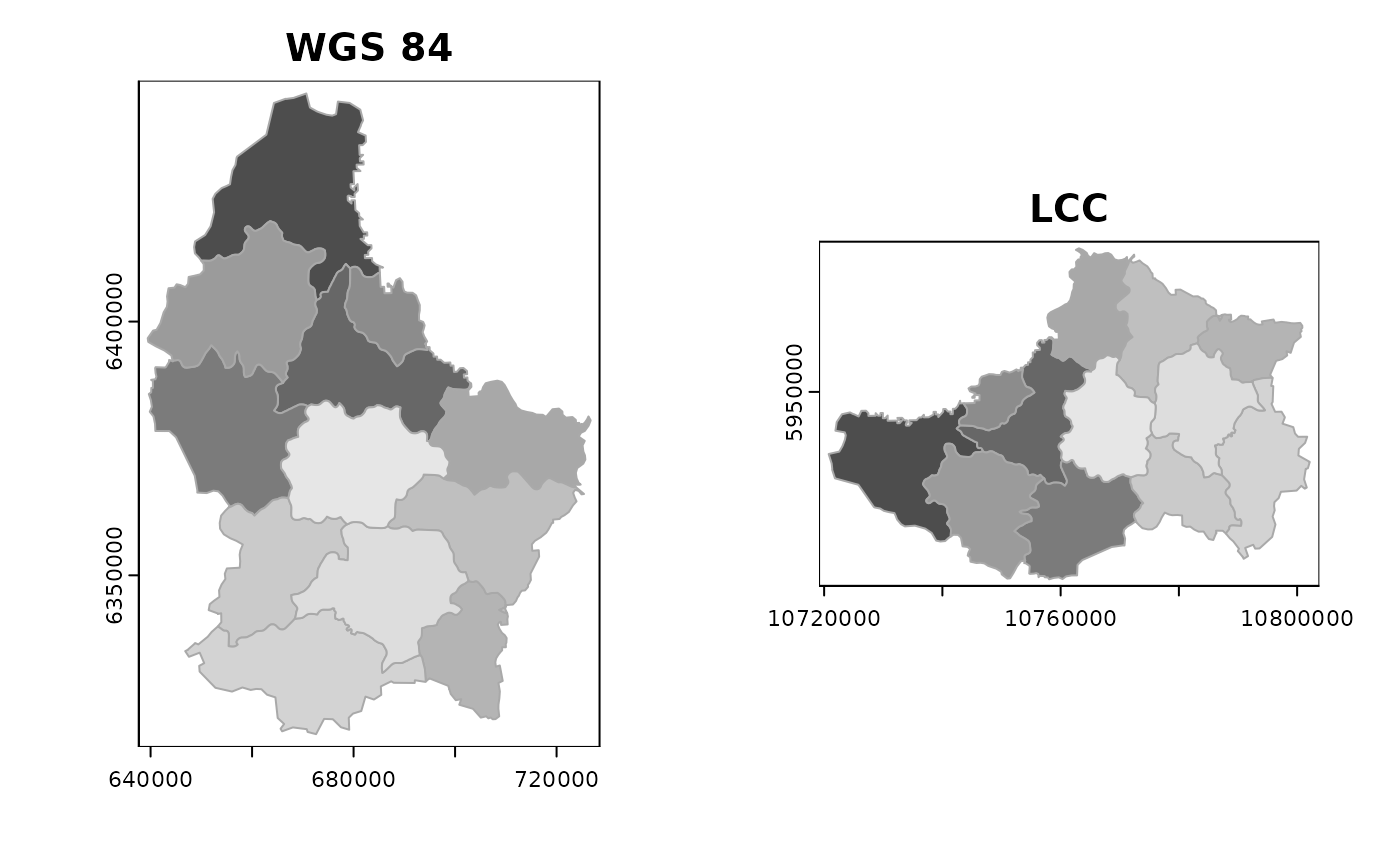
## Reproject to 'WGS 84/World Mercator'
## https://en.wikipedia.org/wiki/Mercator_projection
ogr2ogr(lux, lux_merc, t_srs = "EPSG:3395", overwrite = TRUE)
## Reproject to a Canadian 'Lambert conformal conic projection'
## https://en.wikipedia.org/wiki/Lambert_conformal_conic_projection
ogr2ogr(lux, lux_lcc, t_srs = "EPSG:3347", overwrite = TRUE)

if(require(terra)) {
    op <- par(mfcol = c(1,2))
    plot(vect(lux_merc), main = "WGS 84",
         border = "darkgrey", col = gray.colors(12))
    plot(vect(lux_lcc), main = "LCC",
         border = "darkgrey", col = gray.colors(12))
    par(op)
}

# }
# }